What tools will you use to collect data?
As you design your monitoring plan, you will likely need to make decisions about what kind of tools your program will use to collect and record data. In many cases, it will be important to record spatial coordinates for the data that you are collecting using a GPS or other means. Sometimes, you will need specialized equipment to take measurements or collect samples, such as a water sampling meter or fishnets. Equipment can be expensive, so consider a balance between quality and cost, and ensure that equipment is well cared for and maintained.
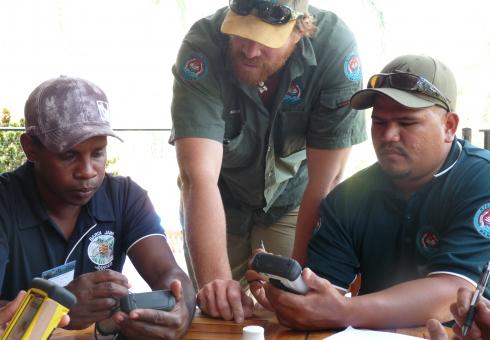
Information can be entered onto paper forms, survey forms, or handheld devices like tablets, phones, laptops, etc. In some cases you may want to photograph or video document observations, or leave remote cameras behind to capture footage. Increasingly, guardian programs have been making creative use of tools like drones, mapping and GIS, social media and open-source and custom applications to gather and document information. Regardless of the data collection tool used, it important to test your methods in the field (and on the analysis and reporting end) and refine and adapt them as you go.
There are pros and cons to using different approaches. Paper forms are easy to use but must be manually input into your data management system. This can be time consuming and create opportunities for error. Hand-held devices can be more efficient and transfer information directly into your database or data management system once back in the office or on wifi. However, these can be expensive, require technical skills or frequent software upgrades, or be affected by cold temperatures, battery issues, software glitches, data loss, etc.
It’s a good idea to reach out to other organizations and communities who have walked this path before you and who are operating in the same geographical, cultural or monitoring context. Connect and ask what tools they have found successful or lessons they have learned along the way